New Hampshire Fire Towers
Currier Mountain (Pine Peak) Tower


Photo Unavailable


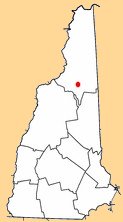
Town: Low & Burbank
County: Coos
Mountain or Hill: Currier Mountain

Height above sea level: 2790 FT
Tower Structure Height: Unknown
Latitude: 44-19-15
Longitude: 71-24-02
First date of operation: 1916
Operating Agency: White Mtn Nat. Forest
Type: Unknown

Other Photos


Notes

  • 1916 -1934, rem. in 1940s
  • Built to overlook major logging slash on the northern slopes of the Presidential Range.


Return to the Main Page